
Computer-Aided Dispatch
Better information for better results.
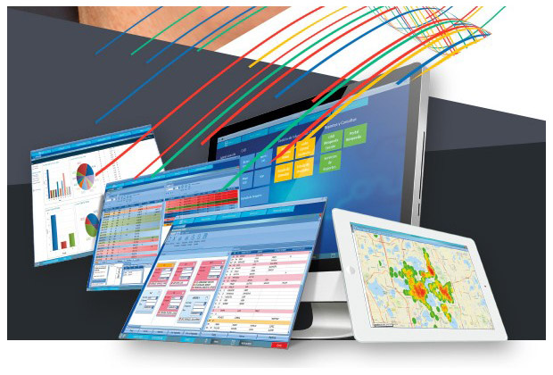
Provide better information to dispatchers with a fast and efficient computer-aided dispatch system that integrates all incident information. CAD System offers flexible deployment options, including on-premises or cloud-based solutions.
CAD is designed to provide a sophisticated system able to satisfy the automation requirements of any Public Safety organization.
CAD was designed and developed according to the unique requirements demanded for supporting and providing time-critical public safety services, and involved direct and hands-on application input from experienced industry experts (Call Takers and Dispatchers).
 CAD
is flexible enough to handle any configuration combination for supporting single or multiple agency operations, combined agency services (E-911 operations, Police, Fire and/or EMS), separate standalone position assignments (i.e., separate Call Taker, Dispatcher, and Supervisor positions), or combined position assignments (e.g. combined Call Taker/ Dispatcher configuration).
CAD
is flexible enough to handle any configuration combination for supporting single or multiple agency operations, combined agency services (E-911 operations, Police, Fire and/or EMS), separate standalone position assignments (i.e., separate Call Taker, Dispatcher, and Supervisor positions), or combined position assignments (e.g. combined Call Taker/ Dispatcher configuration).
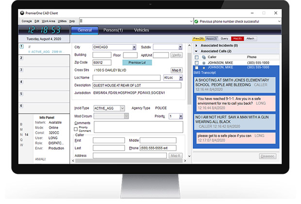
AIEE offered CAD Systems has placed all of the most commonly used functions and features in a single display, eliminating the need for separate menu routines and/or cluttered desktop.
AIEE is a leading supplier in Kuwait of CAD systems working with customers to design and create unique solutions. AIEE also installs and maintains supplied systems.
Features /Benefits
- Windows 10, .NET based application with easy-to-use menus and hot keys.
- Geo based design for street validation, common locations, street aliases, and specific address details. Capable of providing dispatcher and responding field units with advanced functionality including call history, location hazards, standard procedures, routing instructions, special instructions and more.
- User defined selection lists (codes, signals, priorities, etc.), full agency and user screen configuration and defaults.
- Updates without major interruptions for the user (Click-Once™ technology).
- Complete transactional audit that guarantees the security of the information.
- Statistical and business intelligence management for effective real-time decision making, preventive service planning or implementation of public safety policies.
- Multiple configurations, from small agencies to large cities and compatible with SaaS.
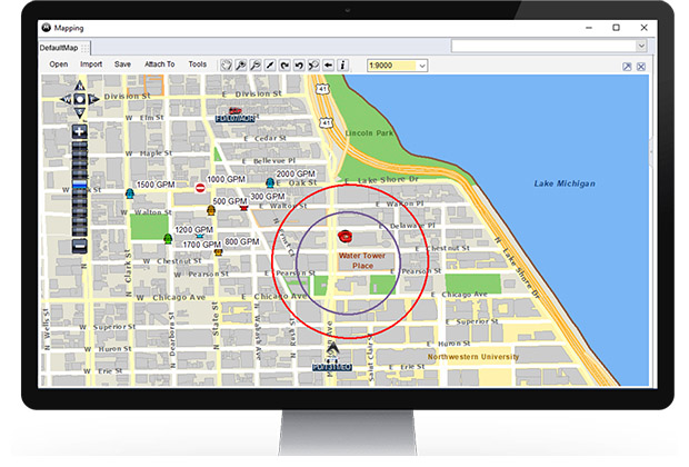
- Integrated mapping compatible with ESRI, Google Maps and other sources for georeferencing.